Pictured Rocks Nat'l Lakeshore
July 2003
 |
![]()
|
![]()
After we left Craig and Tammy's, we traveled up to the north side of the upper penninsula of Michigan and
visited several very scenic places. Enjoy the pictures below, it's a "must see" area in our book.
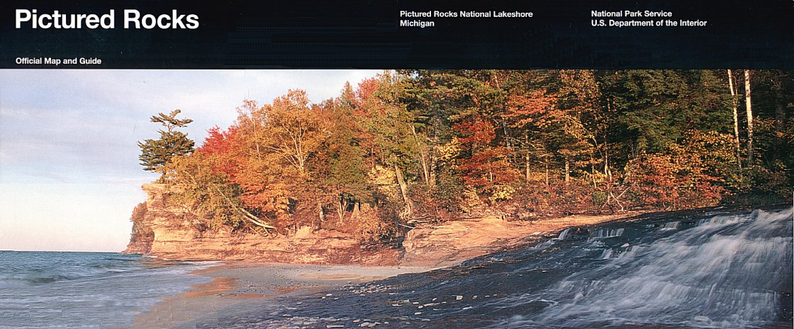
This place of beauty was authorized as the
country's first national lakeshore in 1966 to preserve the shoreline,
cliffs, beaches, and dunes, and to provide an extraordinary place for recreation and discovery. Little more than
six miles across at its widest point, Pictured Rocks National Lakeshore hugs Lake Superior's shore for nearly 40
miles. these 72,000 acres protect a portion of lake Superior's shoreline and watershed.
The name "pictured rocks" comes from the streaks of mineral stain that decorate the face of the sculptor cliffs.
The ramparts of the cliffs are composed of cambrian sandstone of the Munising Formation. The streaks on the
cliffs occur when groundwater oozes out of crakes. The dripping water contains iron, manganese, limonite, copper
and other minerals that leave behind a color stain as water trickles down the cliff face.
![]()
To view any picture on a larger scale just click on it.
Then click your browsers back button to return.
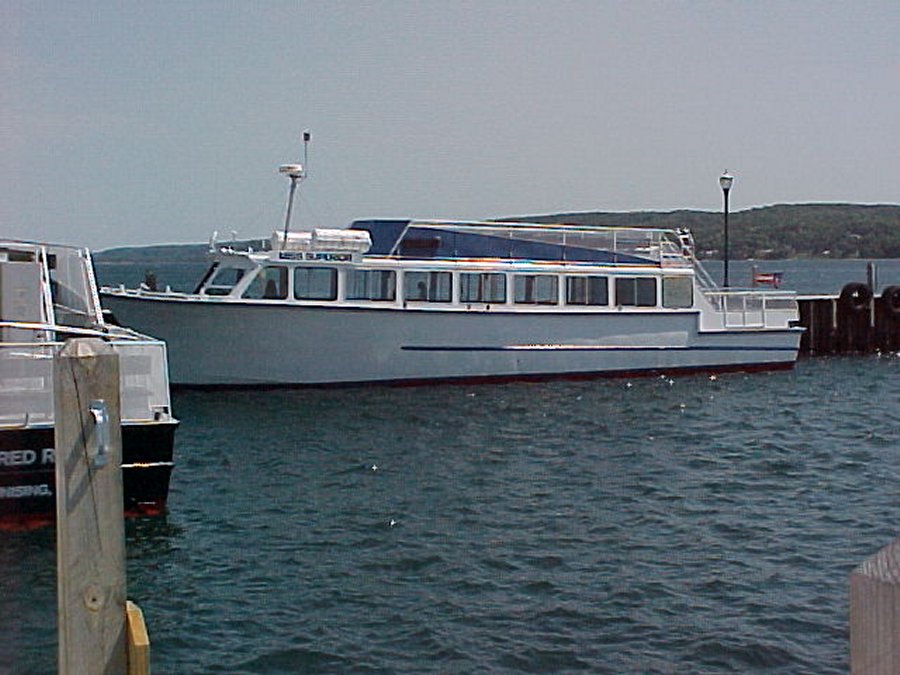 The tour boat we took out of Munising Michigan. |
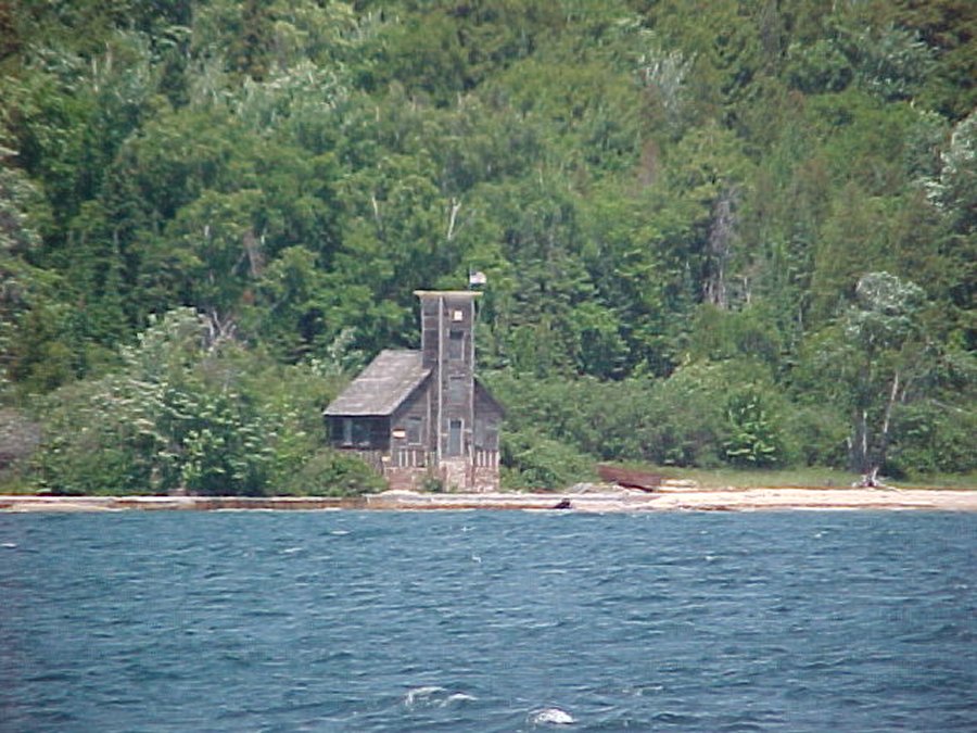 Weather beaten old lighthouse built in 1863 stands along the shore of Lake Superior on Grand Island. The top is missing because of the restore efforts. |
 Lake Superior is the largest fresh water lake in the world and is said if all the water spread over the United States they would be five feet under water. |
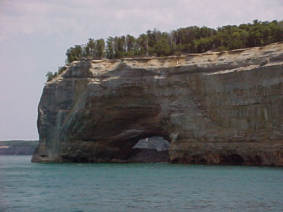
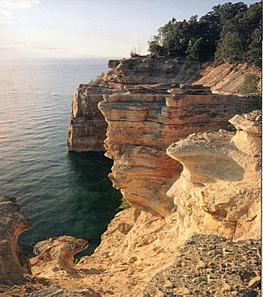 Sandstone cliffs - ochre, tan, brown, sandwiched with layers of white and green - tower 50 to 200 feet above the water. The image is reminiscent of a master's painting: a palette of nature's colors, shapes, and texture. |
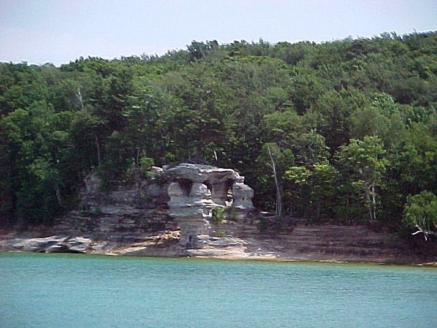
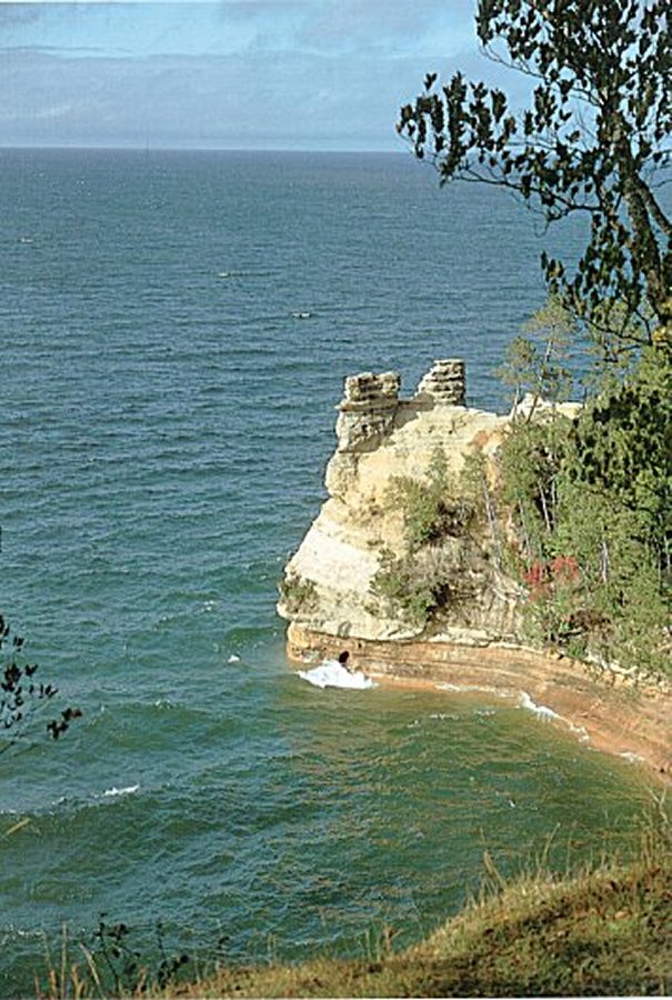 Back in 1772, a mining enterprise failed to locate copper and silver here. Even though no minerals were found the name Miners has since been applied to this "castle" as well as the nearby waterfall, river, and beach. |
 A mile east of Miners Beach. Bridalvail Falls cascades spring runoff into Lake Superior. By late summer, this waterfall will decrease to a trickle, slipping down the five hundred million year old sandstone formation. |
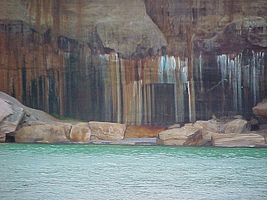 Here is a close up of some of the color in the cliffs. |
 This point is called lovers leap. |
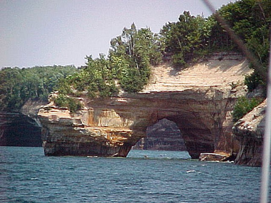
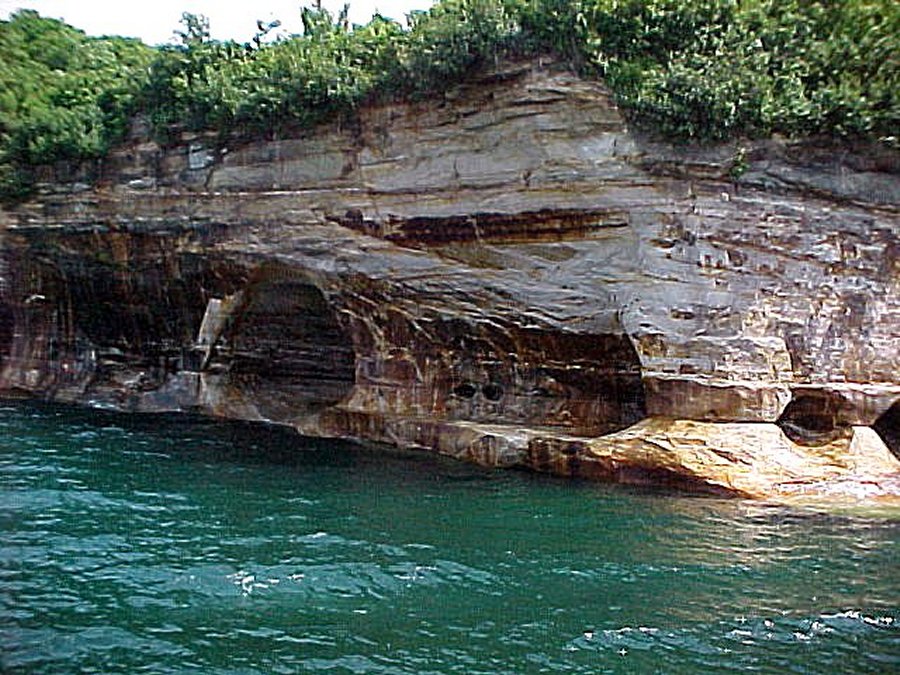 Indians used to put their enemy in the caves and let the sea kill them. |
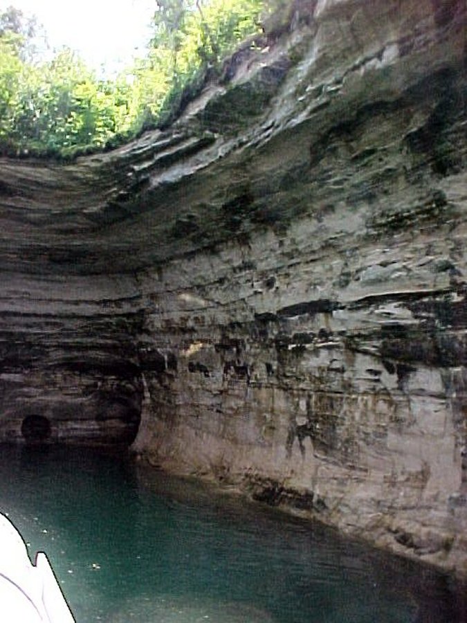
 Large cove used to drive a 85 foot tour boat in and turn it around, before it collapsed. |
 Close up of cove after it collapsed. |
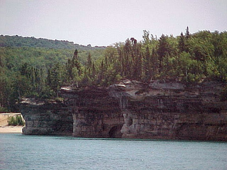 This is called the three battle ships. Looks like they are docked and we can only see their hind ends. |
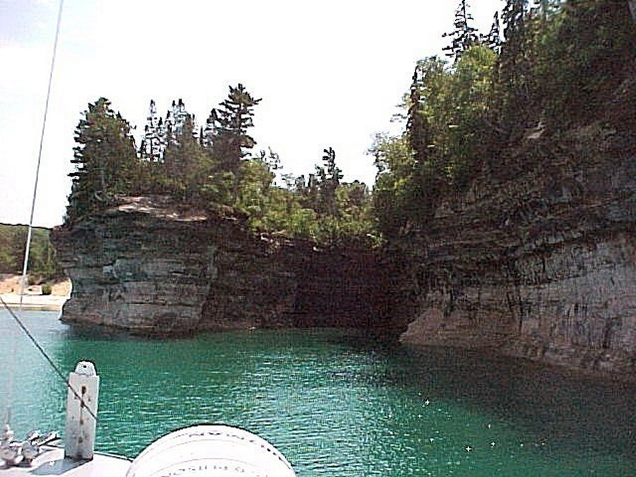 Captain is going to drive the boat into this cove. |
 Walls are about 80 feet high. |
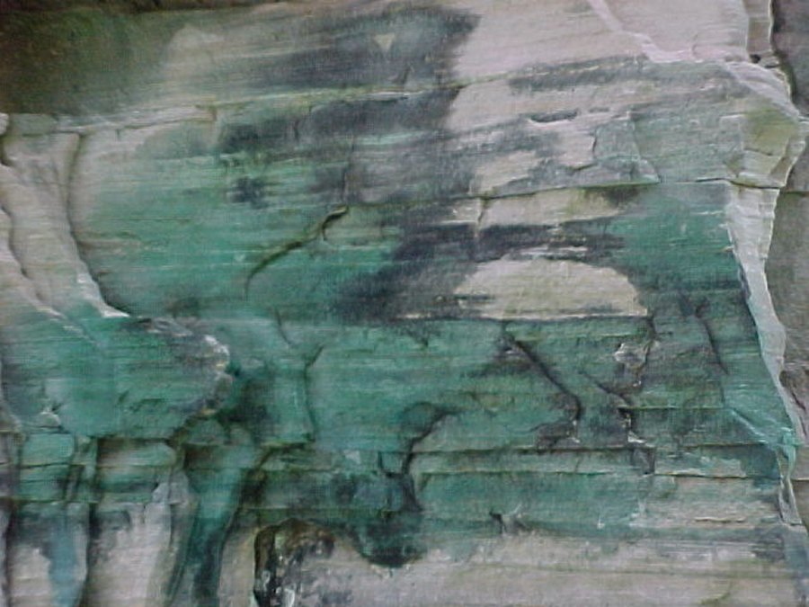 The green in the cliff is copper. |
 This is Mosquito Beach and Falls, the only way to get to this beach is to hike in. |
 This is called Chapel Rock. |
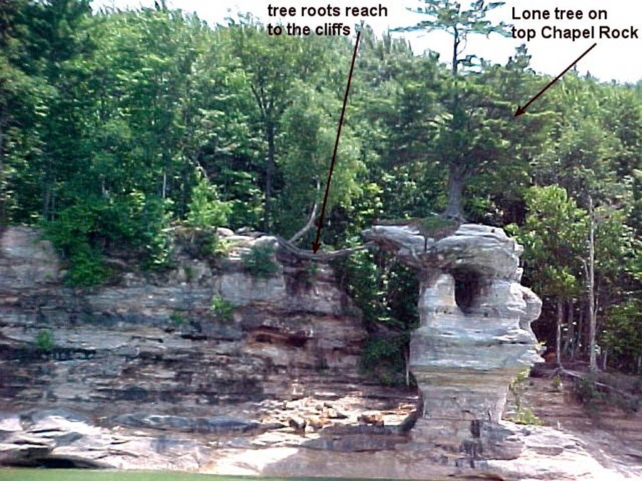 One tree growing on Chapel Rock gets no nourishment from the rock but has its roots going to the cliff. |
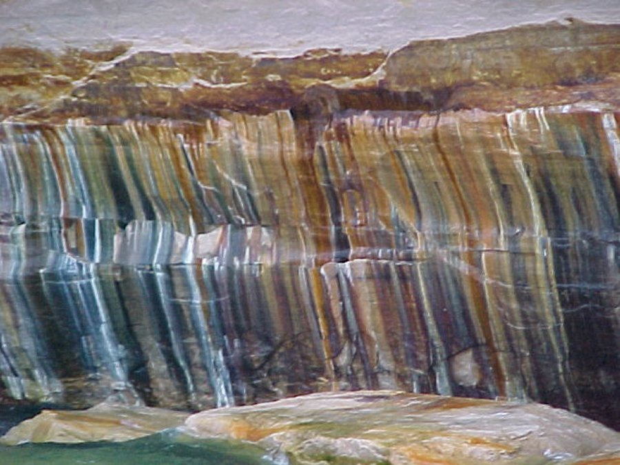 Awesome colors in the cliffs. |
 On the way back they were feeding bread to the sea gulls off the fantail. |
 We later checked out Miners falls on the only road in the park, they are 60 feet high. |
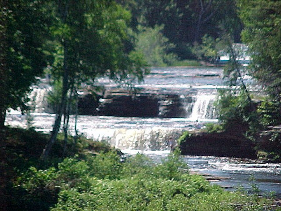
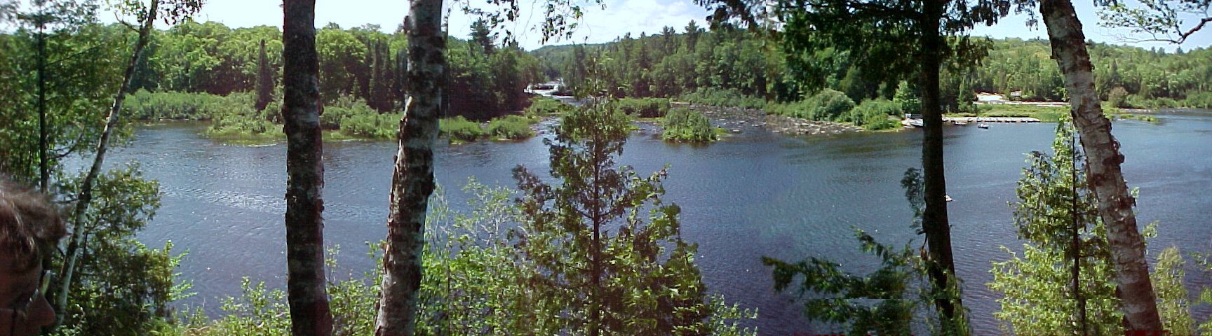 This is the Tahquamemon River showing the island with the Lower Falls on either side of it. |
![]()
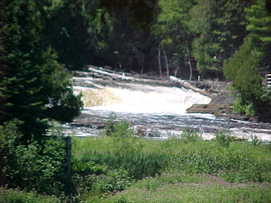
This is the land of Longfellow's Hiawatha - "by the rushing Tahquamenaw" Hiawatha built his canoe. Long before the white man set eyes of the river, the abundance of fish in its waters and animals along its shores attracted the Ojibwa Indians, who camped, farmed, fished and trapped along its banks. Tahquamemon Falls State Park encompasses close to 40,000 acres stretching over 13 miles. Most of this is undeveloped woodlands. The centerpiece of the park, and the very reason for its existence, is the Tahquamemon River, with its waterfalls. We didn't get many pictures because our digital camera is on the blink, sometimes it takes a picture and sometimes it doesn't. The Upper Falls is one of the largest waterfalls east of the Mississippi. It has a drop of nearly 50 feet and is more than 200 feet across. A maximum flow of more than 50,000 gallons of water per second has been recorded cascading over these falls. Four miles downstream is the Lower Falls, a series of five smaller falls cascading around an island. Although not as dramatic as the Upper Falls, they are equally magnificent. The falls can be viewed from the river bank or from the island, which can be reached by rowboat rented from a park concession. The island walk affords a view of the falls in the south channel.
![]()
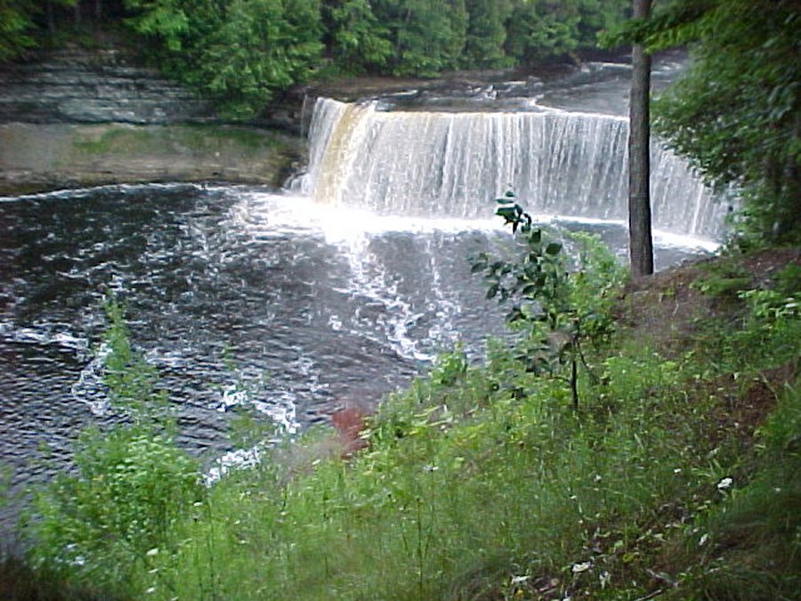 These are the upper Tahquamemon Falls. |
 Close up of the upper falls. |
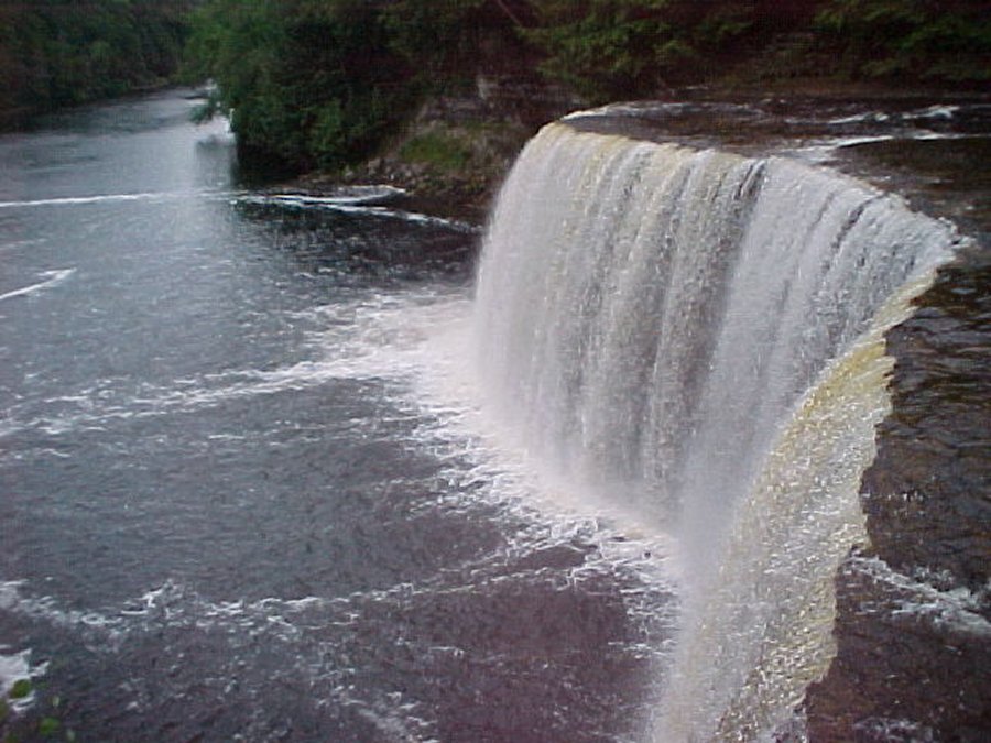 I climbed down 94 steps to get this shot. |
 These are the lower falls on the left side of the island. |
 These are the lower falls on the right side of the island. |
 We spent the night in Hiawatha National Forest campground. |